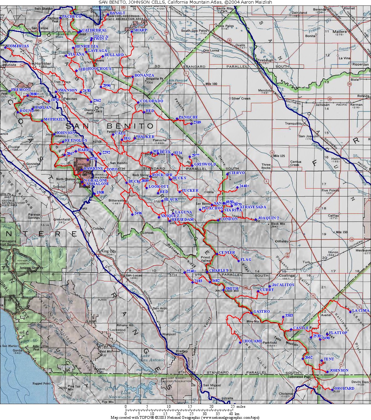
| California Cell Reference Map |
California
Mountain
Atlas Home Page |
Peaklist Home Page |
Notes
and Key to California Mountain Atlas |
| Rank | Summit | Elevation | E(e) | Prominence | Saddle | S(e) | Lat. | Long. |
| 1 | Mt. Johnson | 3465 | 1985 | 1480 | 40 | 36º36'39"N | 121º18'53"W | |
| 2 | North Chalone Peak | 3304 | 1504 | 1800 | 40 | 36º26'51"N | 121º11'45"W | |
| 3 | McPhails Peak | 3353 | 1033 | 2320 | 40 | 36º39'23"N | 121º21'59"W | |
| 4 | Fremont Peak | 3170 | 1015 | 2155 | 36º45'26"N | 121º30'15"W | ||
| 5 | Hawkins Peak | 2725 | 885 | 1840 | 40 | 36º29'17"N | 121º11'51"W | |
| 6 | Mt. Harlan | 3274 | 754 | 2520 | 40 | 36º41'50"N | 121º24'20"W | |
| 7 | South Chalone Peak | 3269 | 629 | 2640 | 40 | 36º26'13"N | 121º11'09"W | |
| 8 | BM Round | 2925 | 605 | 2320 | 40 | 36º41'08"N | 121º28'08"W | |
| 9 | Pt. 2867 | 2867 | 547 | 2320 | 40 | 36º32'23"N | 121º16'11"W | |
| 10 | Mt. Reynolds | 3146 | 546 | 2600 | 40 | 36º35'03"N | 121º16'37"W | |
| 11 | Pt. 2880+ | 2880 | 40 | 520 | 2360 | 40 | 36º44'35"N | 121º25'36"W |
| 12 | Pt. 2236 | 2236 | 516 | 1720 | 40 | 36º31'22"N | 121º10'17"W | |
| 13 | Pt. 1470 | 1470 | 510 | 960 | 40 | 36º43'21"N | 121º20'09"W | |
| 14 | BM Harris | 2763 | 483 | 2280 | 40 | 36º33'07"N | 121º13'18"W |