| Back to the California Mountain Atlas |
Back to the Peaklist Homepage |
U.S. P2000s Homepage |
California Lineage Cell Map |
| NAME
OF REGION |
#
of P2000s Clean |
#
of P1000s Clean |
#
of P500s Interpolated |
||||
| Antonio | 3 |
28 |
105 |
||||
| Charleston/Jefferson | 15 |
65 |
295 |
||||
| Eddy/McLoughlin | 27 |
203 |
888 |
||||
| Gorgonio |
13 |
74 |
323 |
||||
| Jacinto | 8 |
48 |
207 |
||||
| Lassen | 16 |
74 |
286 |
||||
| Pinos |
21 |
116 |
504 |
||||
| Shasta | 9 |
48 |
137 |
||||
| White/Telescope | 13 |
51 |
177 |
||||
| Whitney | 38 |
267 |
1184 |
||||
| TOTAL |
163 |
972 |
4106 |
||||
| REGION |
Area |
List
of all P1000s |
Map |
#
of Peaks with Clean Prominence |
Description |
ANTONIO REGION |
|||||
| ANTONIO I |
San Antonio P5000 cell |
LIST |
MAP |
28 |
San Gabriel Mtns., Santa Monica Mtns, and LA Basin east to Cajon Pass. |
CHARLESTON REGION |
|||||
| CHARLESTON I | Charleston, NV P5000
partial cell |
LIST |
MAP |
44 |
|
| CHARLESTON II |
Jefferson, NV P5000 partial cell | LIST |
MAP |
21 |
|
EDDY REGION GORGONIO REGION |
|||||
| GORGONIO I |
San Bernardino Area |
LIST |
MAP |
32 |
San
Bernardino Mountains and some Mojave ranges
to the east - south of Barstow and west of Bristol Lake, including Ord Mtns., Rodman Mtns., and Bullion Mtns. |
| GORGONIO II | Joshua Tree Area |
LIST |
MAP |
26 |
Joshua Tree National
Park, Chuckwalla Mtns., Chocolate Mtns. Region includes all of Imperial County east of the Salton Sea. |
| GORGONIO III | Granite Mtns Area |
LIST |
MAP |
16 |
Sheep Hole Mtns., Coxcomb
Mtns.,
Iron Mtns., Granite Mtns., Palen Mtns., McCoy Mtns., Little Maria Mtns., and Big Maria Mtns. |
JACINTO REGION |
|||||
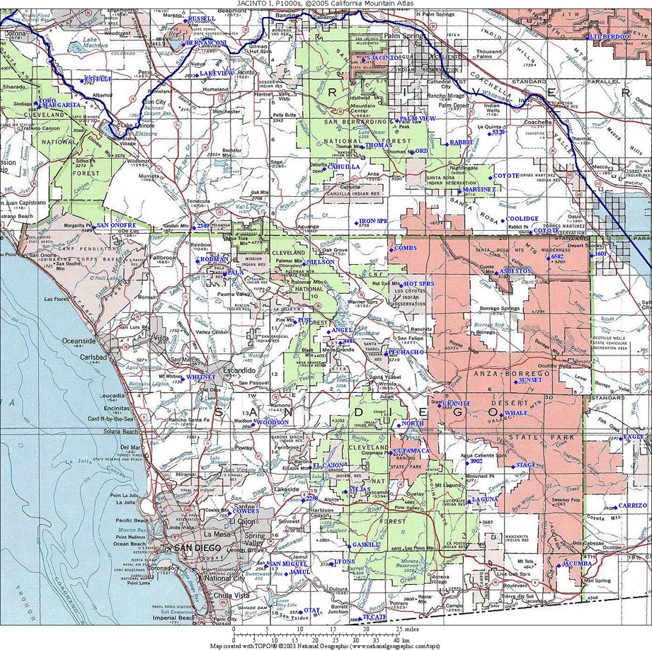
| JACINTO I |
San Jacinto P5000 cell |
LIST |
MAP |
48 |
Southern California Coast
Ranges south of Banning (I-10). Includes Orange, San Diego, and western Riverside and Imperial Counties |
LASSEN REGION |
|||||
| Lassen 1 |
Lassen P5000 cell |
LIST |
MAP |
74 |
|
PINOS REGION |
|||||
| PINOS I |
Southern Bay Area | LIST |
MAP |
19 |
Coast Ranges south from the Sacramento River and San Francisco Bay south to Pacheco Pass. |
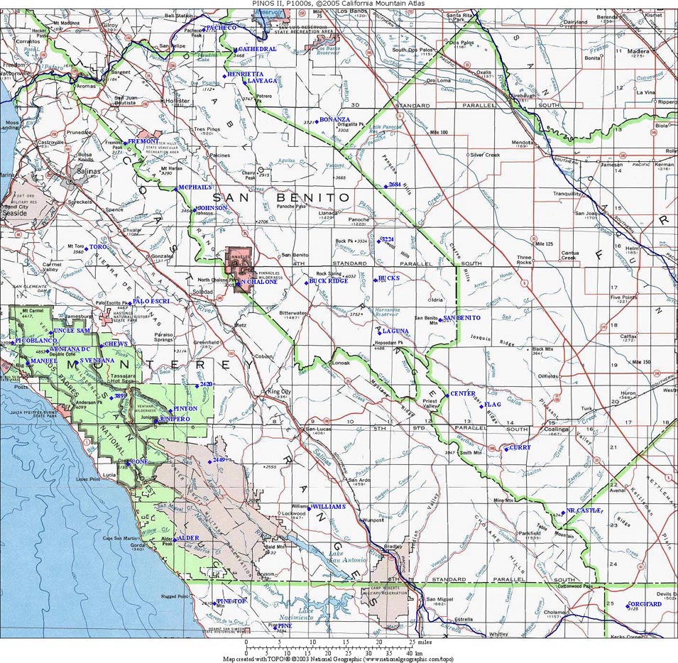
| PINOS II |
Monterey Area | LIST |
MAP |
37 | Coast Ranges south from Pacheco Pass to Antelope Summit. |
| PINOS III |
San Luis Obispo Area | LIST |
MAP |
11 | Coast Ranges from Antelope Summit south to Cuyama River, mostly in San Luis Obispo County. |
| PINOS IV |
Santa Barbara, Ventura,
Tehachapi |
LIST |
MAP |
43 | Coast Ranges including Santa Barbara, Ventura Counties east to Soledad Pass, and including the Tehachapi Mountains northeast to Tehachapi Pass. |
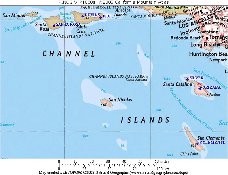
| PINOS V |
Channel Islands | LIST |
MAP |
6 | Six P1000 summits on four of the Channel Islands. |
SHASTA REGION |
|||||
| Shasta I |
Shasta P5000 Cell |
LIST |
MAP |
48 |
|
WHITE REGION |
|||||
| White I |
White Mountain and
Telescope P5000 Cells |
LIST | MAP |
51 |
|
WHITNEY REGION |
|||||
| WHITNEY I |
Tahoe Sierra |
LIST |
MAP |
29 | Northern Sierra Nevada
from Beckwourth Pass/Feather River south to Echo Summit/Middle Fork of
American River, including Lake Tahoe Region. |
| WHITNEY II |
Sierra: US 50 to
Yosemite |
LIST |
MAP |
33 | The High Sierra from Echo
Summit/Middle Fork of American River south to the northern boundary of
Yosemite National Park. This includes the Carson, Ebbetts, and
Sonora Pass areas. |
| WHITNEY III |
Yosemite Sierra |
LIST |
MAP |
49 | The High Sierra including
all of Yosemite National Park south to Minaret Summit near Devils
Postpile and the San Joaquin River. |
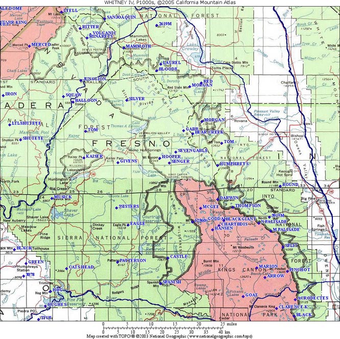
| WHITNEY IV |
Central Sierra |
LIST |
MAP |
42 | The High Sierra from
Minaret Summit near Devils Postpile, south to Sawmill Pass and Woods
Creek/Kings River. This area includes the Palisades. |
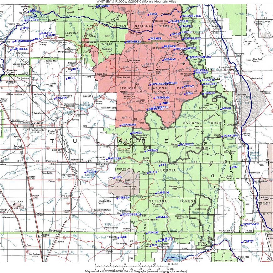
| WHITNEY V |
Sierra near Mt. Whitney |
LIST |
MAP |
65 | The High Sierra from
Sawmill Pass/Kings River south as far as Walker Pass. This area
includes the Whitney Region, as well as the Kern/Kings/Kaweah and
Olancha area to the south. |
| WHITNEY VI | Walker/Tehachapi |
LIST |
MAP |
14 |
The Southern trailing end
of the Sierra, between Walker Pass and Tehachapi Pass. |
| WHITNEY VII |
Trans-Sierra |
LIST |
MAP |
7 |
Ranges east of US-395 and
West of US-6, including Sweetwater Mtns. and Bodie Hills north of Mono
Lake and the Benton Range south of Mono Lake. |
| WHITNEY VIII |
China Lake: Mojave |
LIST |
MAP |
27 |
High Desert north of
Barstow and south of Searles Lake. This is mostly China Lake and
Fort Irwin, and includes the Rand, Granite, Avawatz, Owlshead, Soda,
and Tiefort Mountains. |